When Bankim Chandra Chatterjee composed his famous song, "Bande Mataram", over a hundred years ago in 1882, he was in many ways epitomizing the beauty of Bengal. Some things here are still eternal. Like the rich culture of the state that binds the population together through its unique unity in diversity. Like the matchless geographical variety it offers to visitors. Like the fact that even today, very few diehard Bengalis want to accept the fact that the state was divided during partition and one half of it is now a different country.
Location
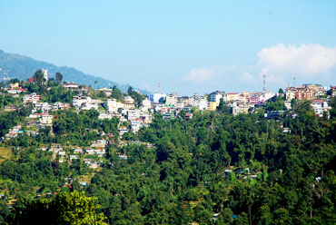
West Bengal, situated in the eastern part of the Indian peninsula, is one of the country's medium-sized states. However, in its physical form, it is a complete representation of the Indian subcontinent. Darjeeling, its northern end, lies cuddled in the arms of the mighty Himalayas and the Dooars in the foothills are rich in forest. The indomitable river Ganga flows across the state's rich alluvial plains to reach the Bay of Bengal in the south, through vast swamps that are known as the Sundarbans. The districts in the west are semi-arid and sport loamy soil: the famous red earth that appears repeatedly in Rabindranath Tagore's poems.
West Bengal extends from latitude 21°31¢-27°14¢ in the North to longitude 86°35¢-89°53¢ in the East. The tropic of cancer runs through the state. Stretching for about 300 miles from the Himalayas to the Bay of Bengal, West Bengal's geography is as diversified as its culture.
West Bengal is surrounded by the three international frontiers in the north, namely, Bhutan, Nepal and Bangladesh. On its northeast lies the green valley of Assam. The vibrating Bihar lies on the western side, while to the southwest lies the state with its golden beaches, Orissa. West Bengal has Bangladesh on its east and the deep blue Bay of Bengal on its south.
History
West Bengal was formerly known as Vanga and was spread over a vast area. Ruled by several dynasties from ancient times, the actual history of this region is, however, available from the Gupta period. The prosperity and the importance of the state increased largely when the British East India Company took over the place. It was a widespread Bengal province until under the terms of the Indian Independence Act, 1947, the province of Bengal ceased to exist. The Muslim-dominated districts, namely, Chittagong, Dacca and part of Presidency and Rajshahi division went to the present-day Bangladesh and the state of West Bengal came into existence in 1947. The district of Cooch Behar was merged with the state on January 1, 1950. The former Chandernogor came within the state on October 2, 1954 and the state got its present political boundary when, according to the States Reorganization Act, part of the state of Bihar was transferred to West Bengal.


